A broad disturbance brewing in the Caribbean Sea has caught the National Hurricane Center’s eye. On Thursday, forecasters said the system could strengthen within five days as it tracks west at 15 to 20 mph over unusually warm waters.
For now, odds of development sit near 20 percent, but meteorologists note that late-October conditions are shifting in ways that could make the atmosphere more welcoming.
Early Signs of Organization Emerge
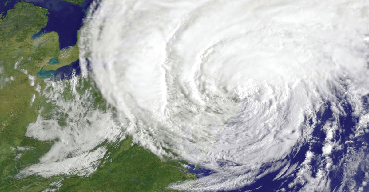
Satellite imagery shows a disorganized cluster of thunderstorms starting to rotate—a signal that the system might be finding structure. “It’s showing early signs of organization,” said forecaster John Cangialosi in Thursday’s outlook.
While far from a named storm, the disturbance has that subtle persistence meteorologists recognize from experience: small convective bursts that refuse to fade even when shear or dry air tries to pull them apart.
Warm Waters Raise the Stakes

Ocean heat across the western Caribbean now runs one to two degrees Celsius above normal. That may sound small, but it’s the kind of thermal edge that can transform a weak wave into a severe storm.
“It’s late in the season, but the ocean hasn’t cooled,” noted NOAA oceanographer Michelle L’Heureux. When wind shear eases, those warm layers can rapidly energize developing systems—sometimes within a single day.
Researchers Expect a Busy Late October

Colorado State University hurricane specialists say the odds favor at least one more significant system this month. “The western Caribbean remains an active zone through the end of October,” said researcher Phil Klotzbach, whose latest report points to above-normal activity until Halloween.
Multiple forecast models now highlight that same region, reinforcing what scientists call the “October window”—a brief but historically volatile stretch of hurricane potential.
Atmospheric Patterns Turn Supportive
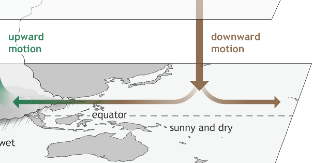
Meteorologists are monitoring a global pulse known as the Madden–Julian Oscillation, which is currently positioned to enhance upward motion across the Caribbean. That shift tends to nurture tropical development.
The setup resembles patterns that preceded late-season hurricanes such as Mitch in 1998 and Eta in 2020. No one is drawing direct parallels yet, but experts say the environmental script feels uncomfortably familiar for mid-October.
A Month That Often Catches People Off-Guard

October can be deceptive. Skies stay mostly clear, and many assume hurricane season is winding down. Yet statistics tell another story: it ranks third for Atlantic storm formation.
NOAA reminds the public that major October storms—like Wilma in 2005 or Sandy in 2012—formed close to land, offering little lead time. “It’s easy to relax too early,” forecasters caution. “But history shows this month still matters.”
An Already Active Year

The 2025 season has kept meteorologists busy. Twelve named storms and four major hurricanes have already developed, pushing the Accumulated Cyclone Energy index to 98, an above-normal total.
Even if the basin quiets, experts say lingering ocean heat means the season isn’t finished telling its story. One more storm could easily make 2025 one of the more memorable years of the past decade.
Models Split on What Happens Next
Forecast guidance remains divided. The European ECMWF model hints at a turn toward Cuba and Florida by October 22, while the American GFS sends the disturbance west, possibly brushing Honduras or the Yucatán before bending north.
Either path could funnel tropical moisture toward the Gulf Coast late next week, adding to the uncertainty that defines so many late-season forecasts.
Flooding Threat Extends Beyond the Core

Even if the system never becomes a hurricane, flooding could still pose problems. Jamaica, Haiti, and the Cayman Islands have seen weeks of heavy rain, leaving soils saturated. A slow-moving tropical wave could quickly trigger landslides.
NOAA warns that the same moisture plume may stretch north into the Gulf states, bringing bouts of heavy rain and localized flooding as far inland as Mississippi.
Emergency Agencies Quietly Prepare

By Thursday evening, Texas and Louisiana officials had begun low-level readiness checks—testing communications, confirming shelter capacities, and coordinating with the National Weather Service. “Preparedness is calm, not panic,” said Jeff Lindner of Harris County’s Flood Control District.
It’s routine work, but the kind that shortens response times if forecasts shift suddenly, as they often do this late in the season.
No Watches Yet, but That Can Change Fast

As of Thursday night, no coastal watches or warnings were active. Still, NHC forecasters warned residents not to let their guard down. “Late-season storms can intensify quickly,” one advisory read, noting that some of October’s strongest hurricanes have formed within 24 hours of classification.
Coastal residents across the Gulf and Florida are urged to review plans now—before alerts become official.
Confidence Builds in a Developing System

High-resolution models increasingly suggest some degree of organization early next week. Whether that means a weak depression or a tropical storm remains unclear. “We’re seeing consistency, not consensus,” one meteorologist explained.
What’s clear is that each satellite pass shows deeper convection and more persistent rotation—signs the system is interacting favorably with its environment rather than simply drifting westward.
Western Caribbean Becomes the Focus

Forecasters agree on one point: the western Caribbean remains the zone to watch. Its deep, warm waters—exceeding 29 °C—provide nearly ideal conditions for storm growth.
That heat extends well below the surface, giving systems enough energy to maintain strength even when wind shear increases slightly. Historically, this pocket of ocean has produced some of the most intense late-season hurricanes on record.
The Next Name on Deck: Melissa

Should this disturbance reach tropical-storm strength, it will be named Melissa, the thirteenth of the 2025 season. Naming is procedural, but it highlights how active the year has been.
Four storms have already reached Category 3 or higher, including Hurricane Dexter, which battered Bermuda in September. For forecasters, each new name serves as a marker in a still-unfolding chapter of an unusually persistent season.
A Five-Day Window Takes Shape

NOAA’s latest ensemble projections now cluster around October 20–25 as the likeliest period for potential development. Satellite imagery shows periodic bursts of convection pulsing through the central Caribbean.
Meteorologists have started referring to this as “the five-day window”—a shorthand reminder that, while forecasts evolve, the next several days could decide whether the system fizzles or finds its footing.
Why the Setup Looks Worrisome
Warm sea temperatures and easing wind shear make an unwelcome combination. When those ingredients align, storms can intensify far faster than models anticipate. It’s a pattern that produced Michael in 2018 and Eta in 2020, both of which strengthened rapidly near land.
Experts say that’s why vigilance matters most now—because October storms have a habit of surprising even seasoned forecasters.
One Storm Can Still Define a Season

Meteorologists often remind the public that storm counts don’t tell the whole story. “It only takes one landfall to change how a season is remembered,” NOAA forecasters said Thursday.
Even after peak season fades, October has delivered some of the costliest hurricanes in U.S. history. The atmosphere may be quieter, but the risk remains until the final front passes in November.
Officials Stress Verified Information

Emergency managers urge residents to rely only on official National Hurricane Center and National Weather Service bulletins. They warn that social-media speculation can spread faster than any storm, but the NHC issues updates every six hours with verified data.
“Follow credible sources,” the agency advised, “and be prepared to act quickly if forecast confidence increases.”
Five Days That Could Shape the Season’s End

As the disturbance drifts westward under bright Caribbean skies, forecasters say the next five days will determine how the 2025 hurricane season ends.
It could fade quietly or take shape into something stronger—but either way, the message remains the same: stay alert, stay informed, and remember that October’s calm surface often hides the atmosphere’s final surprises.