
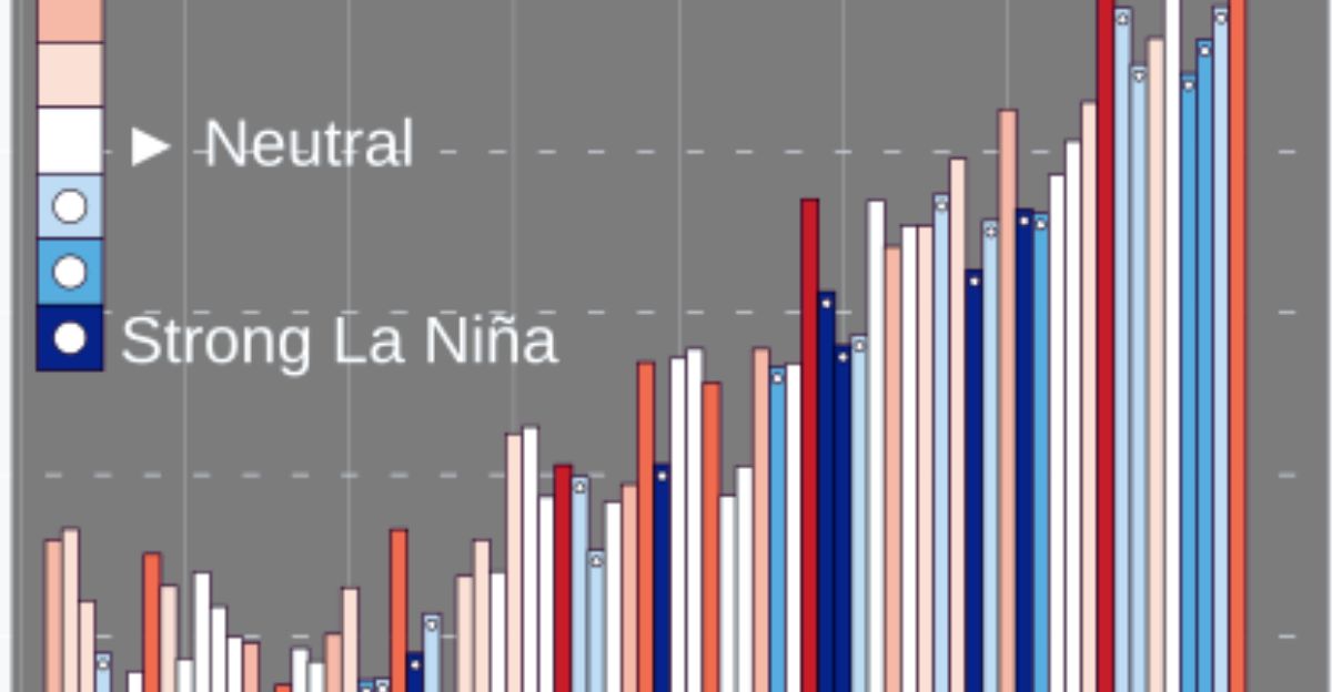
NOAA’s Climate Prediction Center confirmed Thursday, October 9, 2025, that La Niña conditions emerged in September, marking the fifth event in six years. Weekly Niño-3.4 readings dropped to -0.5°C, showing below-average sea surface temperatures across the central and eastern equatorial Pacific.
NOAA scientists noted that this coupling between the ocean and atmosphere is the signature of La Niña, which is capable of nudging global weather patterns even when the event is weak.
A Weak but Noticeable Pattern

Forecasters expect this La Niña to remain weak, with Niño-3.4 values averaging between -0.5°C and -0.9°C through winter. NOAA climatologist Michelle L’Heureux said the readings indicate “a weak but established La Niña pattern.”
Weak events can be harder to forecast than stronger ones, she added, because the signals influencing rainfall and temperature are often subtle — yet even modest Pacific shifts can ripple across North America’s seasonal weather.
Short-Lived Event Expected to Fade by Spring

NOAA assigns a 71% probability of La Niña continuing through December, dropping to roughly 55% by February 2026. Conditions are expected to return to ENSO-neutral between January and March.
That gives the event about five months to influence winter weather, primarily from early December through late February, before the Pacific warms and typical neutral patterns resume.
Ocean-Atmosphere System Shows Clear Signals

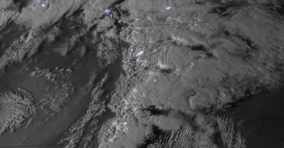
Beneath the surface, the Pacific tells a familiar story. Cooler waters extend from the surface to 200 meters, while stronger easterly trade winds push warm water west toward Indonesia.
NOAA noted that enhanced convection over the Maritime Continent and suppressed activity near the Date Line and a positive Southern Oscillation Index confirm the coupled ocean-atmosphere system is aligned with La Niña conditions.
Global Models Agree on a Weak, Brief Run
International forecasting models, including Columbia University’s IRI and the North American Multi-Model Ensemble, are largely consistent with NOAA’s outlook. The models project La Niña will linger through the Northern Hemisphere winter and weaken by early 2026.
IRI forecasts show La Niña persisting through December and January, highlighting that even weak events can influence regional weather in noticeable ways.
La Niña Could Energize the Atlantic’s Final Storms
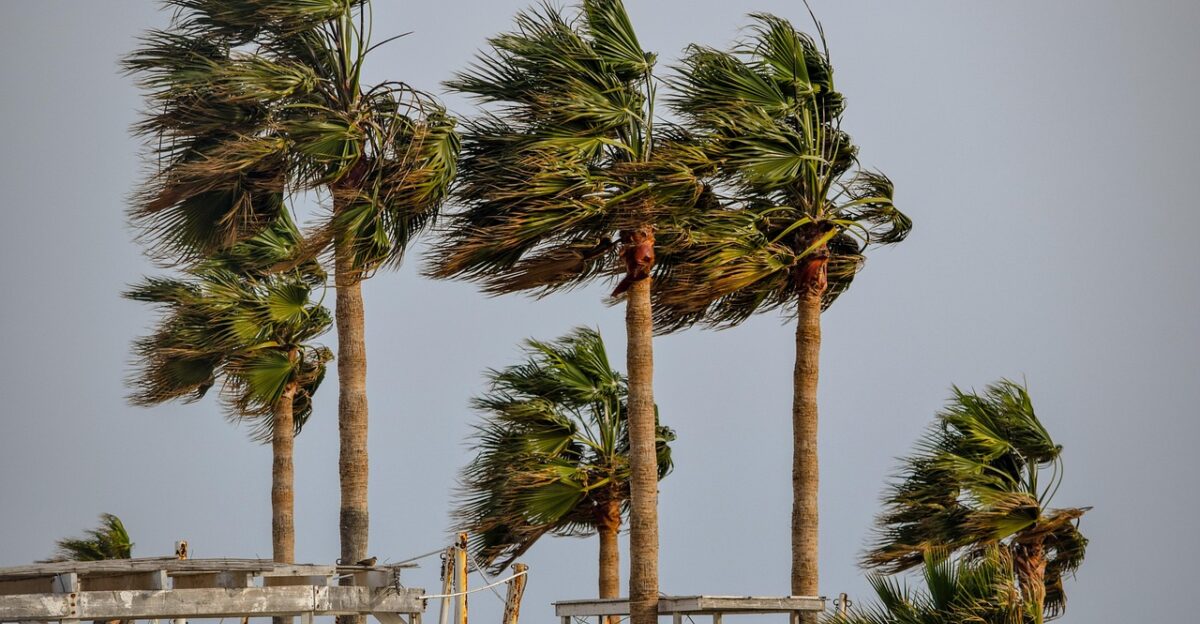
La Niña often reduces wind shear over the Atlantic, which can help tropical storms and hurricanes form more easily. NOAA hurricane forecaster Matthew Rosencrans said that conditions “increase the likelihood of continued Atlantic activity” through November.
Historical data show that La Niña years nearly double late-season storm activity compared with neutral years, raising the potential for additional tropical development before the season ends.
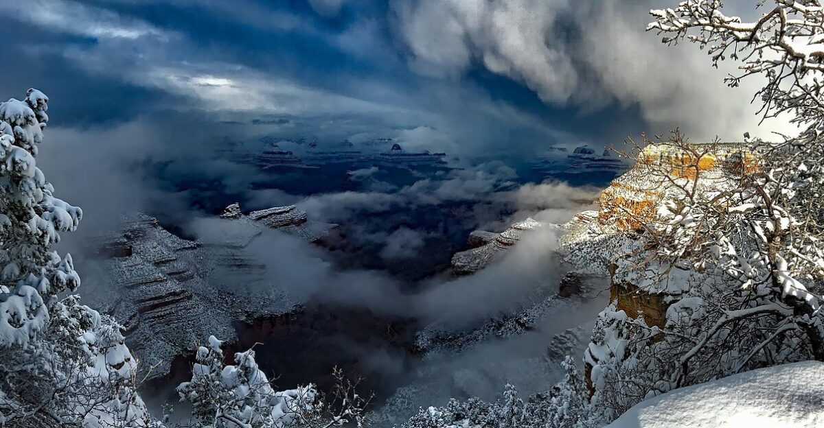
Northern States Prepare for a Chillier Winter

Typical La Niña winters tilt colder and wetter across northern regions. NOAA’s fall outlook favors below-average temperatures in the Pacific Northwest, northern Plains, and Great Lakes.
Early snowpack could benefit winter recreation but also complicate mountain travel. Local forecasters note that, while patterns aren’t guaranteed, the northern U.S. is generally positioned for a classic La Niña winter.
Southern Tier Faces Drier, Warmer Conditions
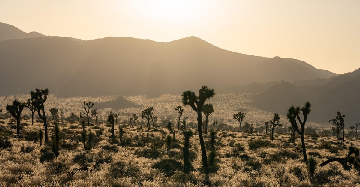
Down south, La Niña usually shifts the jet stream north, leaving southern states warmer and drier. From California to Georgia, precipitation is expected to run below average.
UCLA climate scientist Daniel Swain explained that weak La Niña events often tilt odds toward drier winters in the Southwest, a concern for regions relying on winter rainfall to replenish reservoirs.
Marine Heat Wave Adds a Complicating Factor
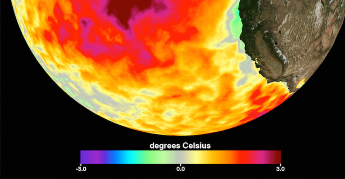
This year, the North Pacific also hosts a persistent marine heatwave known as “the blob,” with record-warm sea surface temperatures. Oceanographer Nick Bond, who first identified the phenomenon, said overlapping warm waters and La Niña create “a complex backdrop” this winter.
The blob could modify storm tracks and dampen some of the typical cooling associated with La Niña, adding uncertainty to seasonal forecasts.
Central U.S. Drought Concerns Intensify
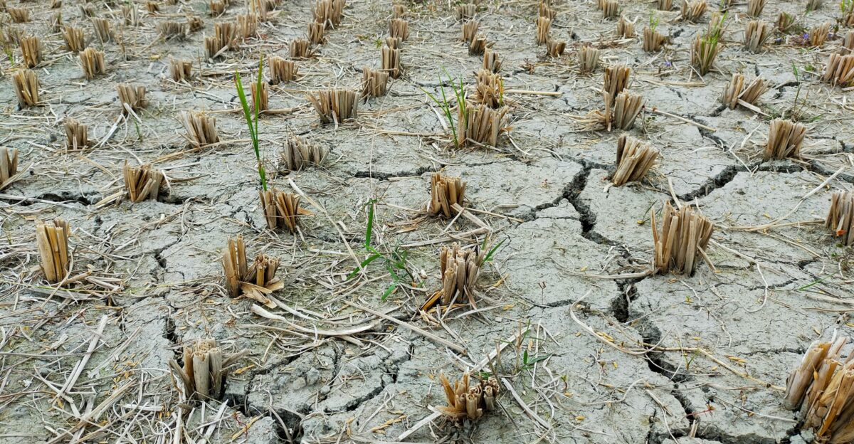
NOAA’s Central Region outlook warns drought may persist or worsen across the High Plains, Midwest, and Ohio Valley through 2025. Soil moisture deficits are already evident, and weak La Niña conditions may amplify drying.
NOAA stressed that agricultural and water-resource challenges in these areas could deepen without steady winter precipitation.
Uncertainty High With Weak La Niña Events

Because the current La Niña is weak, forecasts carry more uncertainty than during stronger events. L’Heureux explained that while temperature trends are relatively predictable, precipitation patterns can vary considerably.
NOAA’s seasonal outlooks often reflect “equal chances” for rainfall in many regions during weak events, highlighting the system’s inherent variability.
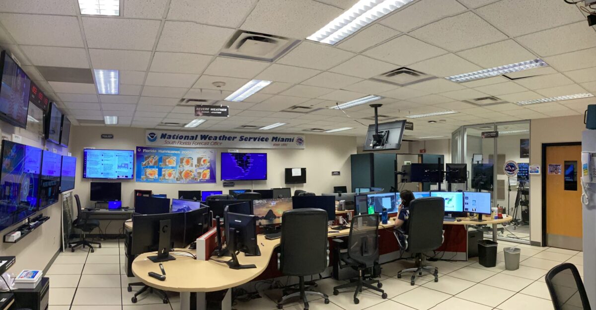
NOAA to Monitor Conditions Monthly
NOAA will continue closely monitoring La Niña through monthly ENSO Diagnostic Discussions, with the next scheduled for November 13. The agency tracks Niño-3.4 anomalies, wind patterns, and ocean convection weekly to determine if La Niña strengthens, stabilizes, or weakens over the winter.
Regular updates allow scientists and regional agencies to adjust forecasts and preparedness plans as conditions evolve.
Rapid-Fire ENSO Swings Continue

This is the fifth La Niña since 2020, highlighting an unusually fast rhythm for ENSO cycles. NOAA scientists note that repeated oscillations between El Niño and La Niña in a short period create challenges for agriculture, water management, and seasonal planning.
This quick succession emphasizes the Pacific’s volatility and the importance of monitoring trends in real time.
Local Weather Services Adjust Winter Outlooks
Across the U.S., National Weather Service offices are updating forecasts to reflect La Niña signals. In the Pacific Northwest, planners emphasize potential early snowpack and flood preparedness. Southern offices focus on drought and wildfire risk mitigation.
NOAA said that each region’s response depends on local factors, and no two La Niña years impact the country in exactly the same way.
How Long It Lasts Will Shape Its Impact

The 55% chance of neutral conditions returning by March 2026 suggests La Niña will peak in early winter and fade later. If the transition is rapid, winter impacts may be short-lived.
If cooling persists, La Niña’s influence could stretch into early spring, affecting river flows, planting schedules, and wildfire potential, especially in areas already stressed by low precipitation.
Agriculture and Water Management on Alert
Water managers in the Southwest are particularly vigilant. California, Arizona, and New Mexico rely on winter storms to recharge reservoirs.
Jeanine Jones, Interstate Resources Manager at California’s Department of Water Resources, said that weak La Niña winters “can create challenges for water management” in drought-prone areas. Northern regions, by contrast, may benefit from enhanced snowpack and soil moisture.
Emergency Agencies Revisit Winter Plans
State and local emergency planners are adjusting their preparations. Northern areas focus on cold-weather response, while southern regions prioritize drought and wildfire readiness.
NOAA noted that early awareness and planning can reduce hazards, emphasizing that preparation should reflect the unique conditions of each region rather than a one-size-fits-all approach.
Maps Show Clear Temperature Divide
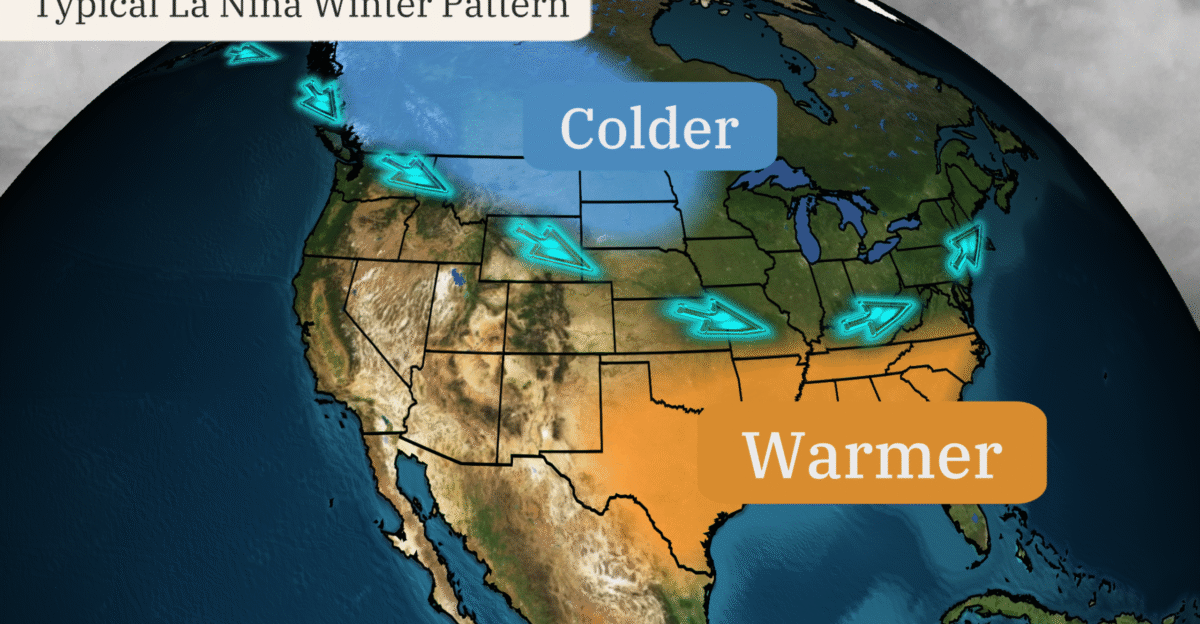
Winter maps reflect the classic La Niña north-south split: cooler than normal in the Pacific Northwest, northern Plains, and Great Lakes, and warmer than average across the southern tier, including Texas and Florida.
This pattern reflects the jet stream dipping south over northern states while arching over the South, shaping regional temperature and precipitation differences.
Hurricane Watch Extends Into November
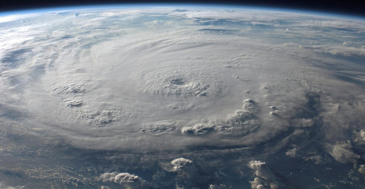
Even as winter approaches, late-season hurricane activity remains possible. With 11 named storms already this year, reduced wind shear in the Atlantic could allow additional tropical development through November.
Historical NOAA data show that La Niña nearly doubles late-season storm activity compared to neutral conditions, emphasizing the importance of continued vigilance along coastal areas.
NOAA Urges Regional Readiness, Not Alarm
NOAA stresses preparation over panic. Northern residents should monitor snow and cold waves; southern states should plan for continued dryness; and coastal regions should stay alert through the end of hurricane season.
The Climate Prediction Center said that even weak La Niña events can subtly shift the odds of which weather patterns dominate, highlighting the importance of region-specific readiness.